


Streets of Houston: Grant Street
The Chicane is the Legacy of the GHSA

This is an edited version of the post previously published as “Deep in the Heart of Montrose.”

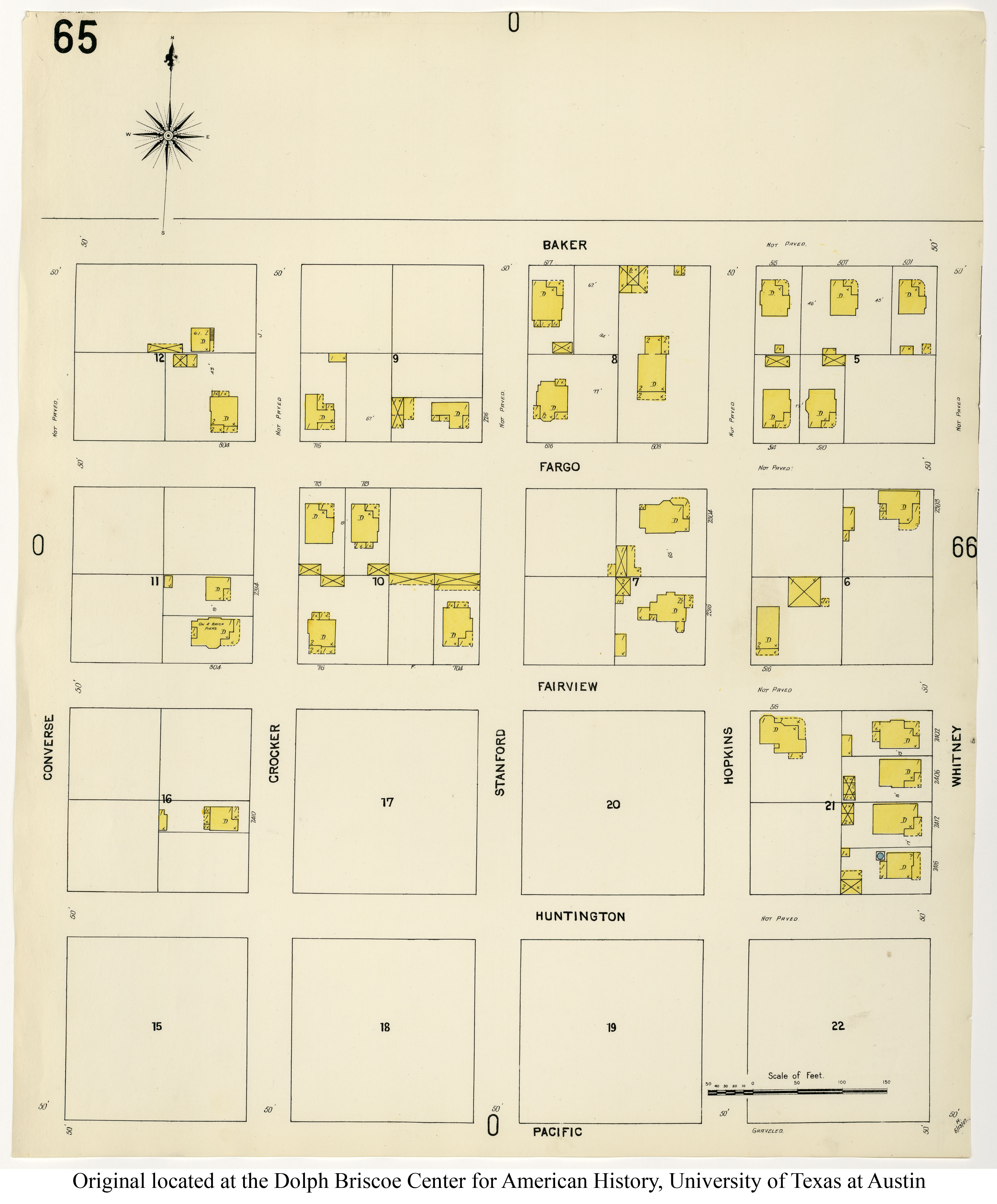
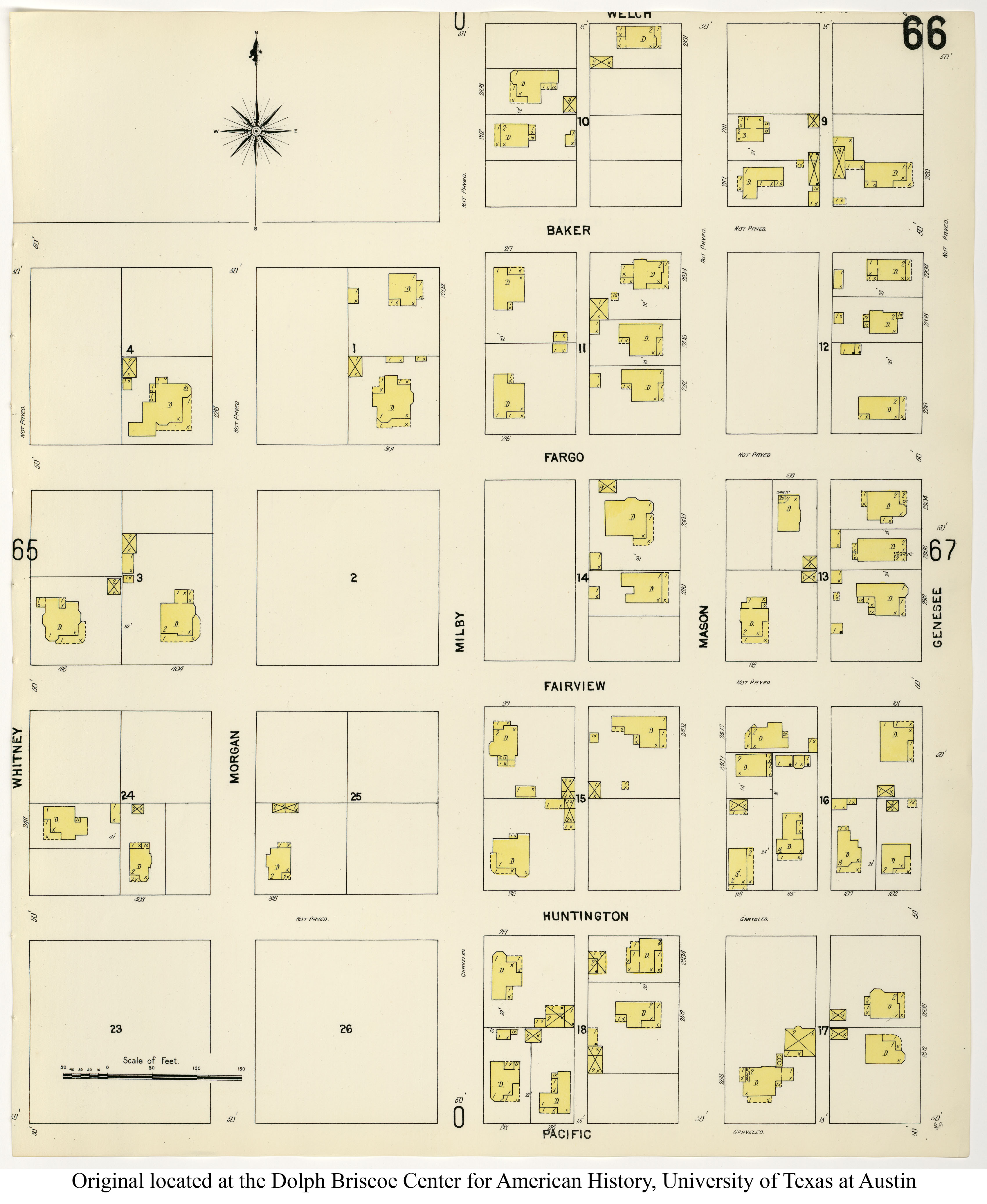
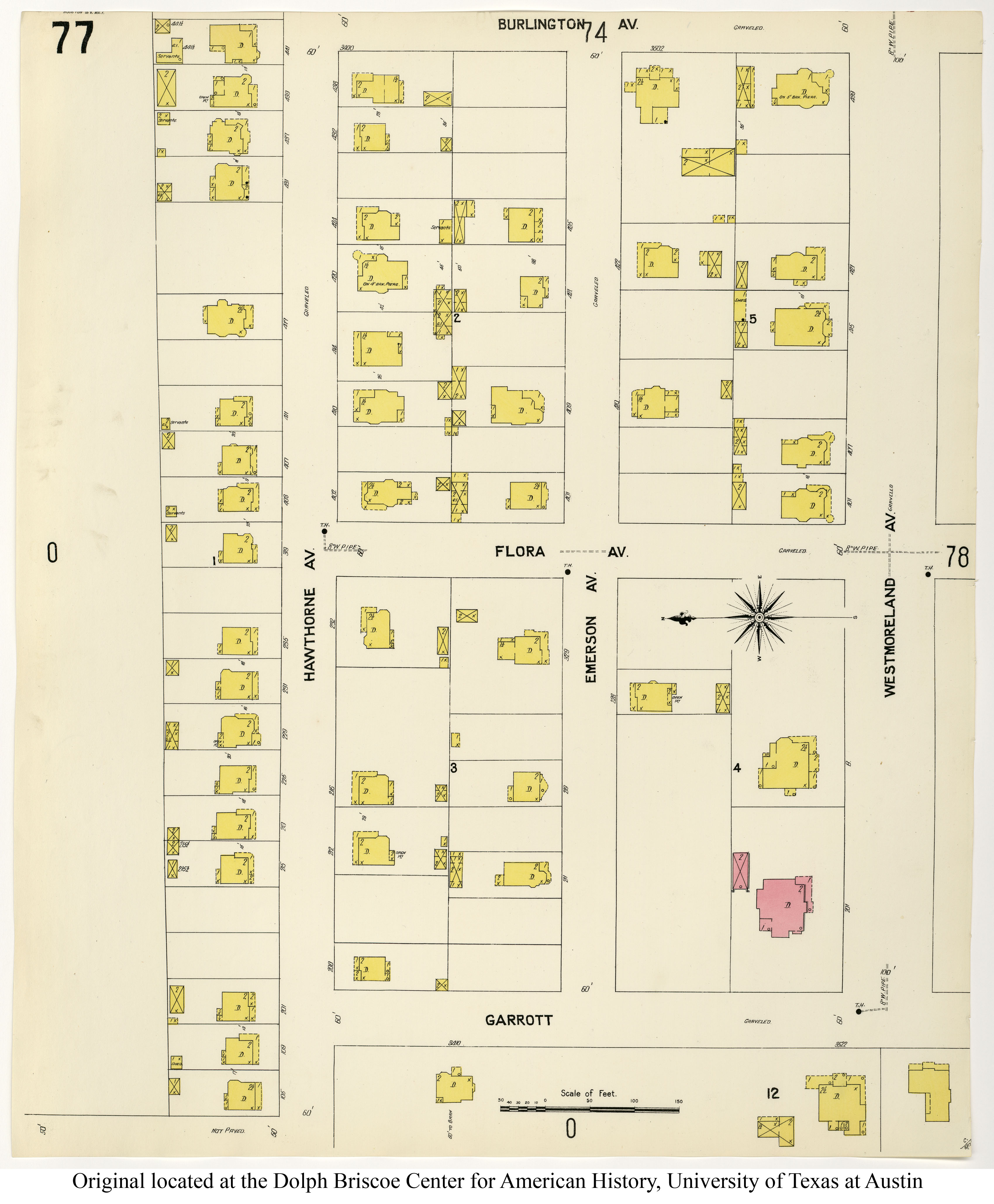
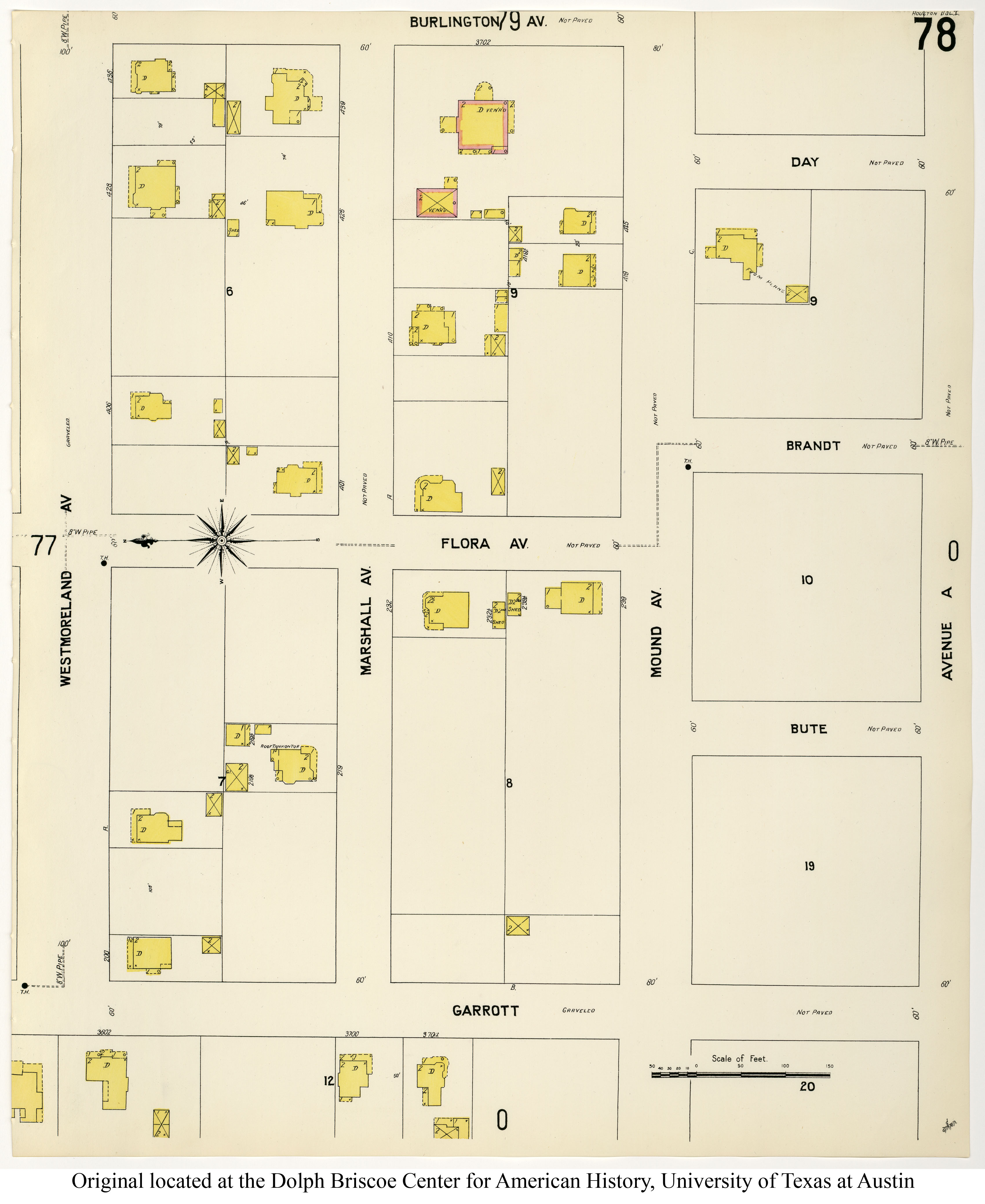
1907 Houston Sanborn Key Map, Volume 1. Source: Perry-Castañeda Library Map Collection, University of Texas Libraries. Annotated by the author.
The chicane in present-day Grant Street conforms to a small section of the former Galveston, Houston & San Antonio Railroad (GHSA) right-of-way. These subdivisions did not coordinate their street plans with adjacent subdivisions. Westheimer and Montrose did not yet exist as long, contiguous rights-of-way.
Grant Street is the name for two discontiguous rights-of-way, deep in the heart of Montrose. This essay concerns only of these rights-of-way; that is, the short street with a southern terminus at Westheimer and a northern terminus at Jackson Street. Grant Street runs perhaps as long as ten-tenths of a mile and roughly parallel to Montrose Boulevard. Yet the short length of the street belies its cultural importance to the neighborhood during the last several decades. Restaurants and bars located on Grant have included Baba Yega, Heaven, and Lola’s, while the street intersects Pacific Street, which is arguably the cultural center of late-twentieth-century Montrose, with Heaven for years serving as the office of the Mayor of Montrose.
In historical terms, central Montrose is a relatively recent development. There was barely anything development there as recently as 1907, the most recent year of a digitized Sanborn Map of the area. While Sanborn did document many streets in 1907, such as Bomar, Willard, and Missouri, most of central Montrose has not yet been subdivided. Bear in mind, Sanborn was a fire insurance company, and they mapped the areas where they considered their potential liability for fire loss to be high. Therefore, we should assume that the unmapped areas lacked significant development. Here are the map facets showing development in Montrose that they did document, and even these do not reveal significant development, except for a part of Westmoreland Place.
One interesting artifact of the 1907 Sanborn Key Map is the right-of-way for the GHSA. “Houston” in the name of the railroad is misleading, since the main purpose of its alignment was to bypass Houston. By 1907, GHSA was a long defunct company after being absorbed first by the Houston & Texas Central (HTC) and finally by the Southern Pacific (SP). The SP acquired and consolidated the Texas & New Orleans Railroad and HTC (with the GHSA), while they continued to construct a railroad beyond San Antonio that was started by the GHSA, and extended it to El Paso, and eventually to California. Eventually, the SP had access to a railroad between Houston and Galveston and used Houston as a regional operations hub, avoiding Houston was no longer served the railroading interest. Meanwhile this bypass was a redundancy for westbound traffic to San Antonio and California. So the SP abandoned this right-of-way.1
In late twentieth-century terms, these tracks continued north through what was later a Sears Warehouse east of Montrose Boulevard (being redeveloped as the Ismaili Center Houston). A viaduct crossed Buffalo Bayou. The intersection of GHSA and the Houston Texas Central Railroad (HTC) was called Chaney Junction. Though this feature is now gone, there used to be a notch in a retaining wall on the north side of Memorial Drive, the vestige of the GHSA right-of-way as it approached the junction. Some large factories emerged at the junction to take advantage of large tracts of land with railroad access. Industry had already developed east of Chaney Junction along the HTC ROW, which ran parallel to Buffalo Bayou. This industrial corridor north of Buffalo Bayou attracted many black and Irish laborers who sought housing a short walk from employment opportunities. Many of these workers resided in boarding houses.
The segment of Grant Street between Westheimer and Jackson is the only remaining vestige of the former GHSA right-of-way west of downtown Houston. In contrast to other railroad facilities in and near Houston which co-exist near residential development, the development of various neighborhoods in Montrose followed from the abandonment of the Houston bypass of the GHSA, with very little evidence of the former railroad right-of-way.
For the most comprehensive history of nineteenth-century railways in Texas, see S.G. Reed, A History of the Texas Railroads: And of Transportation Conditions under Spain and Mexico and the Republic and the State (Houston: St. Clair Publishing, 1941). For histories of the GHSA and SP, see George C. Werner, The Sunset Route: The Centennial of its Completion, 1883-1983 (Houston: National Railway Historical Society, Gulf Coast Chapter, 1983); Joe Dale Morris and George C. Warner, Southern Pacific Lines across Texas and Louisiana, 1934-1961 (Upland, CA: Southern Pacific Historical & Technical Society, 2012); Richard J. Orsi, Sunset Limited: The Southern Pacific Railroad and the Development of the American West, 1850-1930 (Berkeley: University of California Press, 2005).